Red Rock Canyon National Conservation Area Camping
notifications Text me when there's a cancellation at Red Rock Canyon National Conservation Area


Red Rock Canyon National Conservation Area
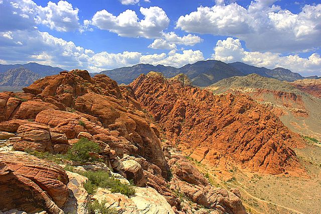
Visit the red- and cream-colored sandstone cliffs and experience the natural wonders of the Mohave Desert just 17 miles west of the Las Vegas Strip. Red Rock National Conservation Area features world-class climbing, miles of hiking trails, a 13-mile scenic loop drive, visitor center, multiple day-use areas and campground. Popular activities include picnicking, hiking, rock climbing, horseback riding, biking, and touring along the 13-mile scenic drive. Visitors must have a timed entry reservation for each day they plan to enter, October 1 to May 31, 8am -5pm. See below to purchase timed entry tickets for the scenic drive, get your backcountry late exit pass, and to reserve a camping spot or the large picnic area in Red Spring. For additional information about Red Rock Canyon National Conservation Area, go to https://www.blm.gov/site-page/RRCNCA.
The Red Rock Canyon National Conservation Area in Clark County, Nevada, United States, is an area managed by the Bureau of Land Management as part of its National Landscape Conservation System, and protected as a National Conservation Area. It is about 15 miles (24 km) west of Las Vegas. More than three million people visit the area each year.
The conservation area showcases a set of large red rock formations: a set of sandstone peaks and walls that were formed by thrust faults including the Keystone Thrust. The walls are up to 3,000 feet (910 m) high, making them a popular hiking and rock climbing destination. The highest point is La Madre Mountain, at 8,154 feet (2,485 m).
A one-way, loop road, 13 miles (21 km) long, provides vehicle access to many of the features in the area. Several side roads and parking areas allow access to many of the area trails. A visitor center is at the start of the loop road. The loop road is also popular for bicycle touring; it begins with a moderate climb, then is mostly downhill or flat.
The Rocky Gap Road in Red Rock Canyon NCA is a side canyon accessible only by an unmaintained primitive road from the scenic loop which mostly only off-road or high-clearance vehicles can access. State Route 159 cuts through the Cottonwood Valley, also a side trail of the Old Spanish Trail. The Wilson Cliffs, a massive escarpment, can be seen to the west from SR 159.
Toward the southern end of the National Conservation Area are Spring Mountain Ranch State Park; the town of Blue Diamond; and Bonnie Springs Ranch, which includes a replica of a western ghost town, but which in 2019 was sold and closed to the public.
Read more about Red Rock Canyon National Conservation Area at Wikipedia
We can help! Many campsite reservations are cancelled daily. Just tell us when you’d like to camp at Red Rock Canyon National Conservation Area, and how long you want to camp for. We’ll text you when a suitable spot opens up!
Scan for cancellationsWhoops! Sometimes we make mistakes. Want to help improve the Red Rock Canyon National Conservation Area listing? Please suggest a correction.
Open to camping at other nearby parks? Here are a few other parks you'll find in the vicinity.
Tell us when, where, and how long you want to camp for. We’ll notify you (via SMS) when a suitable spot opens up at that campground—so you can nab that sold-out campsite reservation!